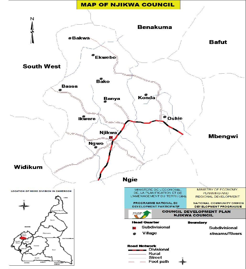
Njikwa Council is found in Njikwa Sub Division in Momo Division of the North West Region. It is located within the grassland savannah area of the mountainous western highland region and forest zone of Cameroon. It is considered a transitional zone as it terminates the savannah grass of the North West Region and begins the forest area of the South West Region. It has a variety in its relief, with altitudes ranging from 1500-1200 above sea levels. The rainfall ranges between 2000 to 3000mm per annum. The dry season is usually from October to February. The nights are very cold while the days are very hot. Annual average temperature ranges between 120C to 400C. The latter temperature is usually being witnessed in the forest zone. It is situated about 64km from Bamenda. It is bounded by Ngie and Mbengwi Sub Divisions to the North and to the East by Widikum Sub Division. To the West it is bounded by Menchum Sub Division and to the South by Akwaya Sub Division in the South West Region. The entire Sub Division covers a land surface area of about 685 square kilometers. According to the recent population and housing census (2005), the council population is 16,634 with men having 8,126 and 8,508 for women with a sex ratio of 95.95%. It is made of 09 villages as follows; Oshie, Ngwo, Konda, Bassa, Bakwa, Ikweri, Banya, Ekwebo and Bako. These villages all migrated from Widikum to their present sites.