This low population density in Toko is due to the dense tropical forest most of which are reserved. These include KORUP Park which occupies a surface area of 49,105 hectares (491.05 km2) which are dedicated primarily to conservation, research and tourism; the RUMPI Hills covers a surface area of 5,445 hectares (54.45 km2) and the Christian Philanthropic Community Forest covers a surface area of 4,928 hectares (49.28 km2). An organization from the United States of America called SG SOC has recently settled (and put in place a oil palms nursery) in Lipenja and is requesting 13,303 hectares (133.03 km2) of land. If granted these organizations will have control of more than 70% of the entire surface area of Toko municipality while the communities that are comprised of the Ngolos, Batangas or Bakokos will be left with about 30% of land on which to engage in farming and hunting. The municipality is endowed with natural resources including stones, rocks, sand deposits, timber (iroko, asube, njabe, mahogany, ebony, sapelle, obeche, bobinga, duzie), NTFP (bush mango, bush onion, febe etc) and wildlife.
Climate
Toko municipality has an equatorial climate where there are two distinct seasons: a long rainy season of about eight months and a relatively shorter dry season of about four months. The annual amount of rainfall ranges from 3500mm to 5000mm.The rainfall pattern provides suitable conditions for the growth of both perennial and annual crops thus allowing for two cropping seasons a year. Rainfall is a major determinant on agricultural production in terms of the crops grown, the farming system and the sequence and timing of farming operations.
Daily temperatures are relatively moderate throughout the year and ranges from 20°C to 30°C. Humidity varies with the absolute value and the seasonal distribution of rainfall, being uniformly moderate throughout the wet season, and falling to lower levels during the dry season
Soils
The Toko municipality has rich clay loam and lateritic soil type which is very fertile for agricultural production. This has greatly influenced the cultivation of both cash and food crops. Due to poor farming techniques in the area, the soil is gradually losing its fertility.
Relief
The topography is undulating with hills and slopes ranging from between 200 to about 1000m. Hence, movement from one village to the other within municipality which is done primarily on foot as result of the poor road network is very difficult.
Hydrology
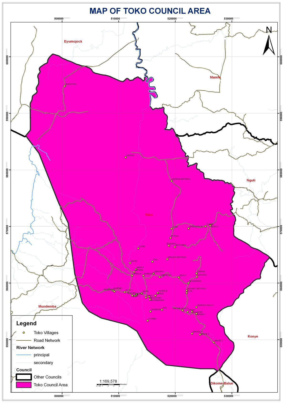
The Toko council area has so many streams, springs and waterfalls which have direct bearings with the river Meme which takes it rise from the Rumpi Hills as it drains the highlands of Madie, Dikome Balue and the coastal lowlands of Mbonge in the Meme Division before emptying into the Atlantic Ocean. The Combrany River which originates from within Toko municipality also empties itself into the Meme River. Thse features can serve as potential touristic sites within the municipality when developed. Despite the seemingly abundant availability of water, only three villages have made meaningful effort at having portable water supply including Madie Ngolo, Madie New Town and Toko. The rest of the population depends entirely on springs, sreams and rainfall as sources of drinking water.