Kombo Abedimo is one of the Municipalities in the Bakassi Peninsular which is situated in the South West Region of Cameroon. It is a Mangrove and creeks dominated area measuring about 700sq km, rich in sea and petroleum products and having strong touristic and Agricultural potentials.
- Agriculture
Climate
Kombo Abedimo and the entire Bakassi zone have a prevailing equatorial climate with temperatures ranging from 20 to 31 degree Celsius and it is characterised by a three month Dry season and a long rainy season that lasts for 9 months.
The Kombo Abedimo council area has the equatorial type of climate which is characterized by two distinct seasons: the rainy and the dry seasons. The dry season runs from October to March .February is the warmest month with average temperature of 31.9 °C at noon.
Soil Type
The environmental impact Assessment carried out by the Mount Cameroon Project (MCP) in 2000, shows that the main type of soil found in this municipality is composed of sandy and salty alluvium and is subject to seasonal flooding. This soil type is very good for agriculture especially Cassava cultivation.
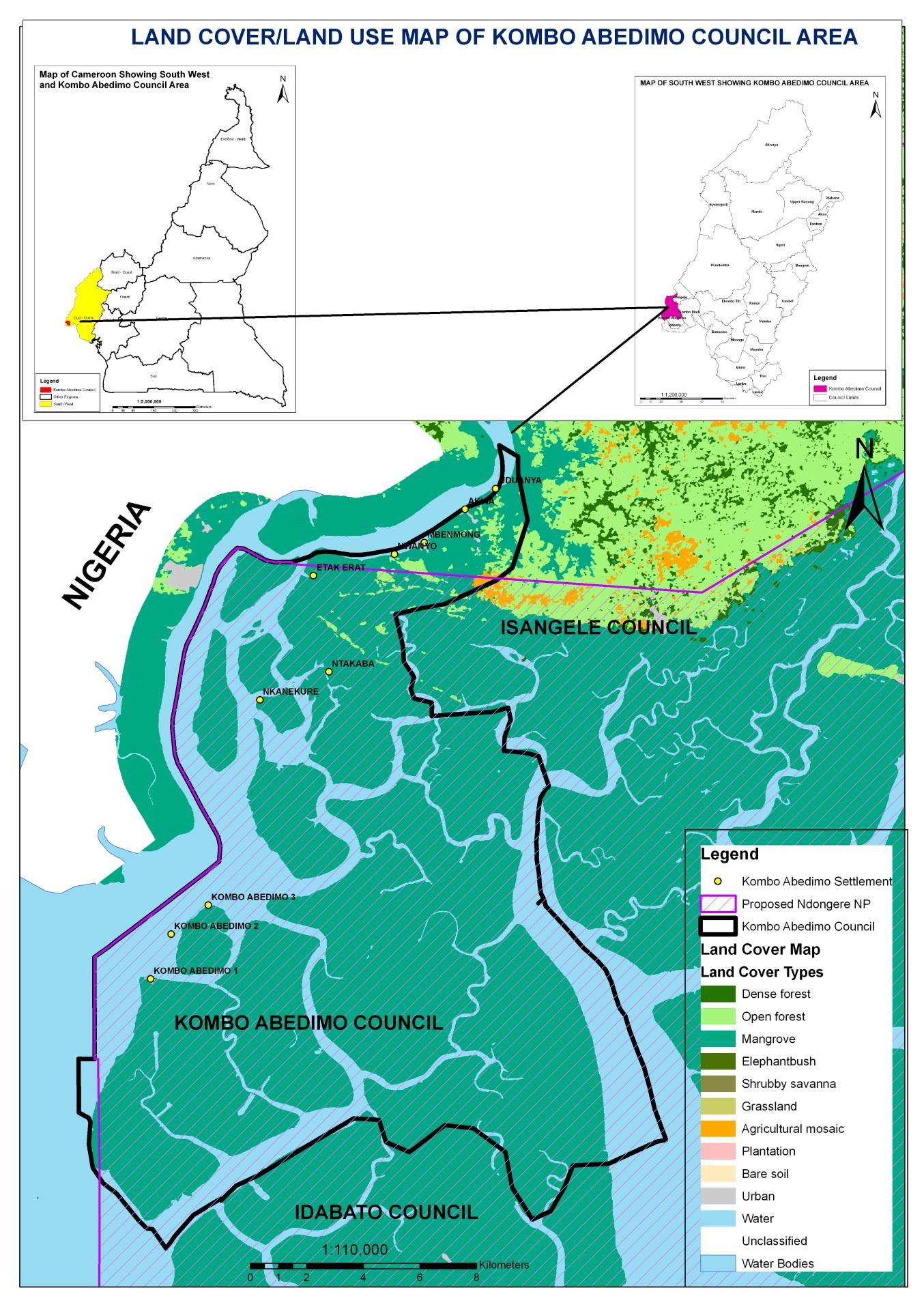
Relief
Kombo Abedimo has a gentle sloppy relief. The Kombo Abedimo Municipality stands out as a gentle relief area with generally lowlands. There are areas as low as 1m and even less in altitude around the maritime villages of Nkanekure, Etak-Erat, Ntakaba, Kombo Abedimo 1,2and3 which are below the sea level. The council has an average altitude of 18m and is interrupted to the east by Mount Cameroon. Close to the Atlantic Ocean are the mangrove, swamps, several Creeks and sand-spits that stretch from the rocky coast lines of Fako to the Ndian River Basin. The relief of the council area is generally a gentle slope.
Hydrology
The land of the council is blessed with so many water courses including rivers, stream and borehole. The names of these rivers include river Akpa Yafe, Akwayafe, Ngosso and Bakassi creek. The maritime area of the council is covered by sea and most of the villages found within these areas are Island.