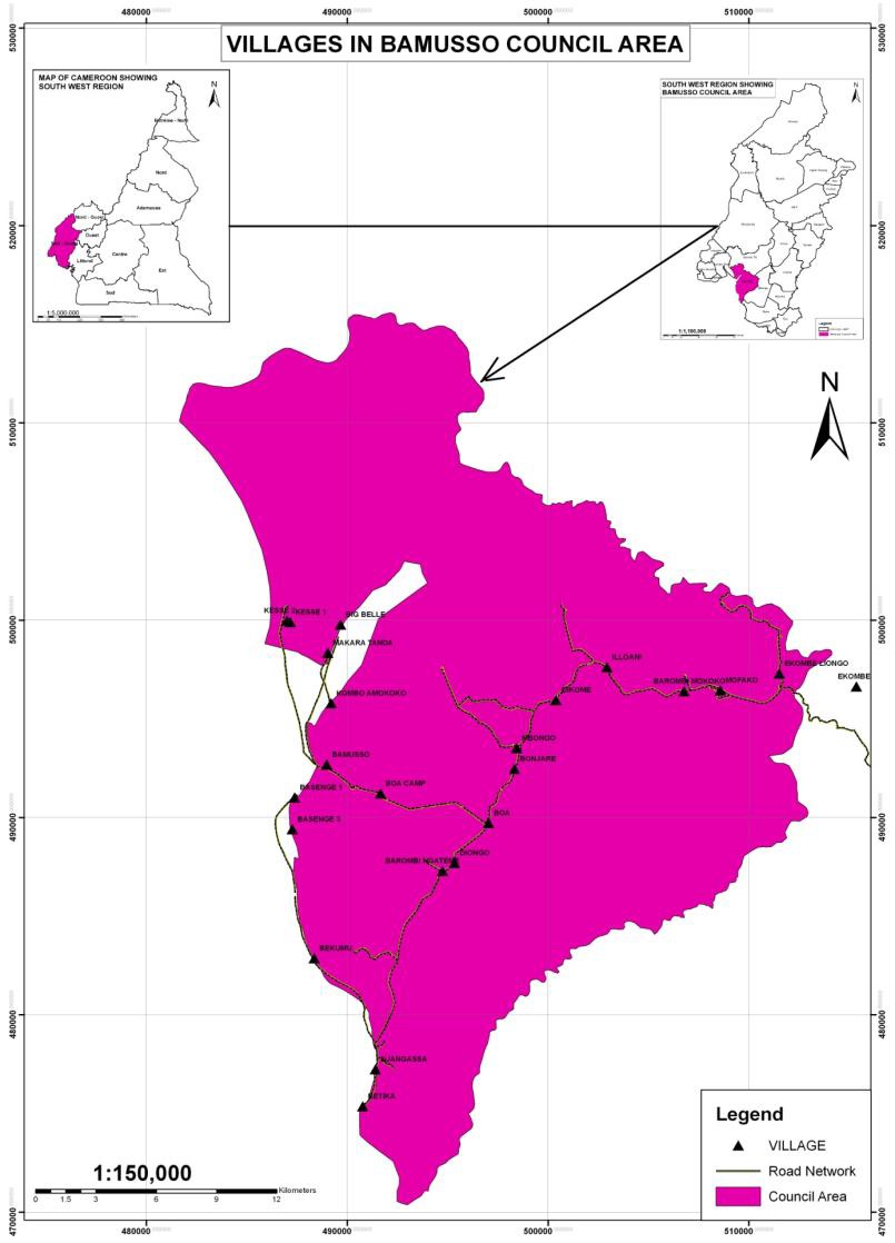
Bamusso is the head quarters of the Bamusso Sub division. Bamusso town is located some 25km from Mbonge. The Bamusso Council has a total surface area of 885km2 with an estimated population of 95,674 inhabitants living in 27 villages. It is located between latitude 4033’N and longitude 9001’E with an altitude of about 80m in the mainland area above sea level and -5m in the maritime area which is below sea level.
The municipality has geographical boundaries with the Federal Republic of Nigeria to the North, to the South and West by Mbonge Sub-division and to the East Idenau Council. The average temperature range is about 300C and mean monthly rainfall of about 2500mm to 5000mm.
Climate
The Bamusso council area has the equatorial type of climate which is characterised by two distinct seasons; the rainy and the dry seasons. The dry season runs from October to March and is characterised by high temperatures of about 32-350C.
The rainy season begins from March and ends in October with its peak periods in July and August with an average rainfall of about 5000mm, relative humidity: 100% Wind: 2 mph and average temperature range of about 25.5-270C.
The dry season is characterized by dry winds that blow across the Sahara desert from a North East to a South Westerly direction. During this period, daily temperatures are high with a slight drop in the night. During the rainy season rains are heavy creating a favourable environment for rain-fed cultivation. The rains are occasionally associated with storms that are destructive to crops and property.
Soils
The Environmental Impact Assessment carried out by the Mount Cameroon Project (MCP) in 2000 shows that, the main type of soil found in this municipality is composed of Sandy and silty alluvium and is subject to seasonal flooding. The hills are a dissected plateau of old volcanic rocks with a few up-faulted sedimentary belts. These soil type is very good for plantation agriculture especially palms and cocoa.
Relief
The Bamusso municipality stands out as an area gentle relief with generally lowlands area. There are areas as low as -5m altitude around the maritime villages of Kesse, Bekumu and Ngatame which are below the sea level. The council has an average altitude of about 90m and is interrupted to the east by the Mount Cameroon. Close to the Atlantic Ocean are the mangrove swamps, several creeks, and sand-spits that stretch from the rocky coast lines of Fako to the Ndian River Basin. The relief of the council area is a flat surface which is gentle.
Hydrology
The main land area of the council is blessed with so many water courses including river streams, spring and borehole. The names of some of these rivers include river Meme which takes it rise from the Rumpi Hills drains the highlands of Madie, Dikome Balue and the coastal lowlands of Mbonge in the Meme Division before emptying into the Atlantic Ocean Combrany River which also empty itself to the Meme River. At the upper course of the Meme River navigation is hampered with two heavy Waterfalls in the Ekombe areas which the village Ekombe waterfall got its name. The maritime area of the council area is cover by sea and most of the villages found within these areas are islands.