Konye is also host of decentralized government institutions like
- the Sub divisional officer,
- Sub delegation of basic education,
- sub delegation of agriculture,
- forestry,
- and livestock.
- CIG’s and cooperatives
Konye sub division is rich with the following mineral resources Stones for the extraction of gravel at Baduma and Mbakwa supe , Pouzzolane along the road to Eboko bajou from the Konye market, sand along the villages of Baduma, Kokaka, Ngolo Bolo, Dikomi etc, but the exploitation is very minimal.
SENSITIVE ZONES
There are sensitive zones in Konye municipality. Dikome, Konye, Kokaka, Matoh, Ikiliwindi have swamps. Mbakwa Supe has flood zones and landslide areas. Kurume has steep slopes. These areas have been abandoned by the inhabitants.
VEGETATION
The vegetation is mainly forest, characterized with cocoa, Timber, Rubber, Palms and fruit trees. It also consists of vast wetland areas consisting mainly of mangroves and a vast expanse of cocoa farms. The fauna appears to have suffered a lot of pressure. Indeed, despite the almost permanent presence of the forest, the animals are difficult to see. They are far from residential areas, given the reduction in their living space by logging and agriculture.
Fauna
The following animal species are significantly found in Konye: Mammals Bushpig (Potamochoerus porcus), Antelope (Antilocapra americana), Monkey(Cercopithedae), Porcupine(Erethison dorsatum), Deer(Odocoileus hemionus), catarh beef,), Ruminants Cutting grass(thryonomyidae), rat mould(Rattus rattus), squirrel(Rodentia Sciurus), Reptiles( snakes), Livestock( goats, sheep, pigs, fowls,rabbits snails) The trend of rare species reduces as you move away from the enclave forest areas towards more settlement zones.
Natural Resources
The principal mineral resource identified in the area is sand. It is found in all the villages along river, Baduma, Dikomi, Kokaka, and Bolo Moboka. Access is free but the use is loosely coordinated, very traditional. Wood is abundant in the forest areas covering many villages of the council space. The villagers use it as firewood or for construction. Loggers, usually illegal, make intensive use, contributing to a strong degradation of forest cover. However, forest also provides non-timber products, including Njansa, Bush peper, colanut, and bamboo. It is found at Mbonge meteke, Kokaka, Itoki, Upper ifanga, Mwangala. Access is free but it is under exploited.
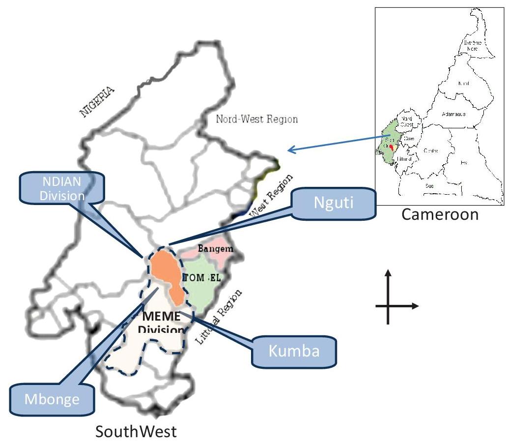
Konye is located along the Kumba – Mamfe road in, Meme division, in the South-west region of Cameroon. It is bounded in the north by Nguti council, the south by Kumba council, the East by Tombel council and in the West by Dikome Balue.
The Konye council was created in 1977 following presidential degree N° 77/203 of June 29 1977. It went operational in July 1978 with headquarters in Konye.
- Agriculture
- Cattle Breeding and Fishing
- Hunting
- Forest Exploitation
- Collection of Non timber forest products (NTFP)
- Handicrafts
- Commerce
Climate
The climate falls within the equatorial climate (Cameroon type) with an annual rainfall of 3000mm-4000mm. It is characterized by the wet and dry season, the dry season last from November to February, while the rainy season extends from March to October. The average annual temperature is 27 ° C.
Soil
It has characteristic soft black, red, stony, sandy soil which is heavily leached during heavy rains. The soil is fertile for the production of cocoa and food crops.
Hydrology
In addition, the district is watered, the Mungo, Mengeh, Moke, Nyale, are rivers that run through its frame and physical space. In addition, many other rivers, streams, springs waterfalls are visible at the village level.