The development of Tinto Council Area depends on a clear identification and exploitation of its potentials and resources. The main potentials and resources that avail themselves in this municipality can be classed as natural, human, financial and relational
Naturally, Tinto is blessed with a long raining season and a short dry season. This makes the area rich of water resources in the form of streams, rivers and springs. This climatic condition is favourable for rain fed agriculture and two-cropping season a year for cereals. In addition to the abundant water in the streams, rivers and springs, there is a huge potential for supplying rural water supply schemes and water for irrigation. Irrigation systems can used to encourage market gardening in the municipality.
Presently much of the area is not habituated – under forest cover. This forest resource is a great potential for development. First is provides potential land for agricultural expansion, which if well organised will not be detrimental to other environmental objectives. Second with only three community forest there is abundant potential for the establishment of more community forests in the municipality. In line with the creation of community forest, the exploitation of NTFPs can be better organised, as source of community income and council revenue; which will contribute in no small way towards poverty alleviation.
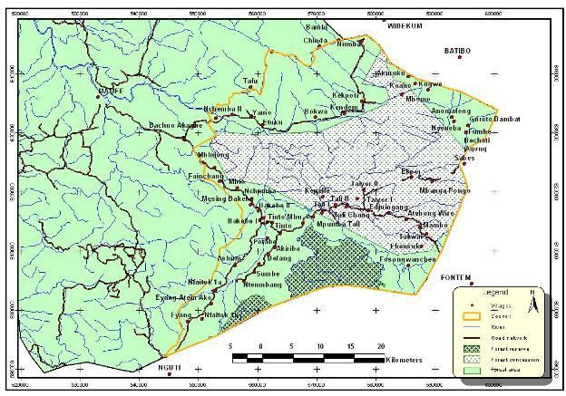
The ‘Upper-Bayang’ Sub Division was created by a presidential decree in 1992. The Tinto Council was created by presidential decree No.93/321 of November 1993 and went operational in 1996 and became the main economic life wire of the Sub-Division. The Sub division is lodged in the heart of a dense tropical rain forest. The dense forest has equally attracted forest exploitation interests, ecotourism and non timber products harvesters.
Tinto Council shares boundaries with councils in both the northwest and southwest provinces. The council is bordered in the North by Mamfe Central and Widikum Councils, in the east by Tinto the south by Eyumojock, Nguti and Menji councils.
Tinto council area falls within the heart of a dense equatorial forest rich in biodiversity. The biophysical environment today comprises of forest cover which is highly is facing timber exploitation, agricultural areas and human habitation.
The Tinto municipality falls within the Equatorial Climate Zone. It has the Equatorial Rain Forest Climate, which is characterized by two distinct seasons; the rainy and the dry seasons. The dry season runs from October/November to March and is characterized by elevated temperatures 30°C-32°C. The rainy season starts from March/April and ends in September/October with an annual average rainfall ranging between 3500mm-4000mm, and peak periods in the months of July and August.
The area is richly watered by the Manyu, Mbu and Mfi rivers and their tributaries. These rivers are prominent rivers that join to make up the "cross river" that flows into Nigeria. Some streams do exist in the area like; Aler, Baliye etc.
Three main types of soils exist dominant and include Sandy soils, Humus or Topsoil: and Red Clay soil.
Generally, the Equatorial Rain Forest occupies the area and it also falls within the Tropical Evergreen Forest type of Cameroon. It is part of the Guineo-Congolian Floristic region. Two forest types are found in the area - The lowland rain forest type and The mid-altitude Forest type. The forests are rich in flora and fauna resources – timber of all sorts, NTFPs and wildlife varieties.