The Nguti Council has a total number of
- 7 nursery schools,
- 40 primary schools,
- 14 Secondary schools,
- 4 hospitals,
- 6 Health centers,
- 1 socio cultural infrastructure,
- 4 community generators for electricity and 3 Mini hydropower plants.
The entire Sub-Division has approximately
- 4 bore holes and catchments which supply water by gravity using stand taps.
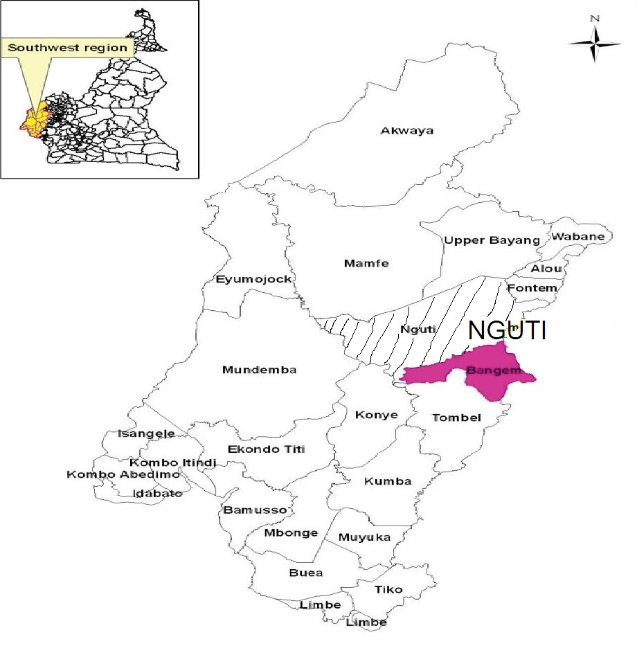
The Nguti Council is located in the Nguti Sub – Division in Kupe Muanenguba Division of the South West Region of Cameroon. The Council is located at 05.32902º N and 009.42562º E at an altitude of 238m. It is bounded by Mamfe and Upper Bayang in the North, Konye and Tombel in the South, Mundemba in the West and the Littoral Region in the East.
The Council was created in 1967 but only went operational in 1968. At the time of its creation, the council was run by the Divisional Officer. The first appointed Mayor was Chief Enoh Adamson Akule in 1985. The following have been Mayors, Mr. Achuo Peter, Mr Esapa Peter Besong, Mr. Nhon Mbome Joseph and now the current Mayor Mr. Tanyi George Ayompe.
- Agriculture
- Animal Husbandry and Fishing
- Hunting
- Forest Exploitation
- Craftsmanship
- Services/Private Sector
Relief
Hills, steep slopes, deep valleys, low lands, rugged and undulating surfaces. The dominant physical feature of the municipality is huge tropical forest mixed with secondary and primary forest.
Wildlife
The forests are home to several types of primates especially the monkeys and also elephants. There are also the bush pigs, porcupine, cutting grass, birds of assorted types including the parrot.
Flora and Vegetation and Protected Areas
The biodiversity is great with hundreds of species. There are several protected areas particularly the Bayang Mbo sanctuary; the Korup and the Bakossi Park. Others include village traditional protected sites for cultural activities.
Climate
Generally of the equatorial type with two main seasons; a short dry season of about four months [November to February] and a long rainy season [March to October] wet most of the season with an average temperature of 25oc to 35oc. The rainfall is unevenly distributed in the municipality. The relative humidity is very high above 75%. The short dry and long rainy season, high temperatures, high rainfall, high relative humidity are suitable for diverse agriculture.
Soils
The Soils are very fertile in the Rumpi hill areas but of reduced fertility in the Mbo areas.There are various types of soils ranging from laterite, sandy, humous and clay and are generally acidic which are suitable for farming especially the cultivation of cocoa, coffee, banana, oil palm, rubber and a great variety of food crops such as plantains, cocoyams, yams cassava, egusi, maize, pineapples.
Water Resources
Several small streams and rivers some all year round and others dry up in the dry season. Some have waterfall of small and medium sizes suitable for water systems by gravity as the case in Talangaye and hydro electricity in Nguti.