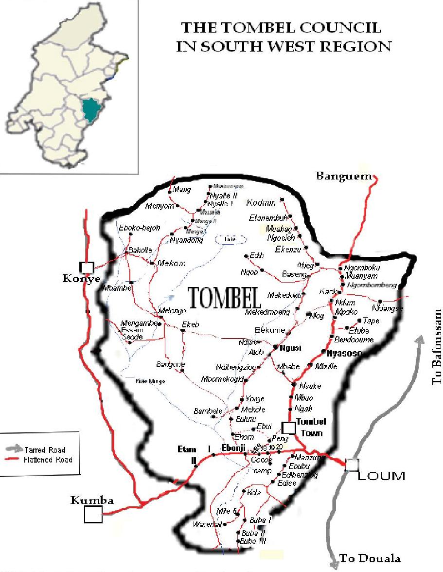
Tombel council is located in the South West region of Cameroun. It is situated between latidude 04°16’ and 05°15’ north and longitude 09°13’ and 09°15’ East. It lies on the western side of the Kupe Mountain from where the name Kupe Muanenguba division. Geometrically, Tombel is likened to the African continent with its Northern part large and the southern part reduced. It covers a surface of 1007 Km2 and has a population of 110 178 inhabitants.
- Agriculture
- Cattle Breeding and Fishing
- Hunting
- Forest Exploitation
- Collection of Non timber forest products (NDFP)
- Handicrafts
- Commerce
- Services ( Private Sector)
Climate
The climate of the subdivision is typical of tropical nature with all year warm temperatures, abundant rainfall, which coupled with rich soils, support rich natural forest and a wide variety of tropical crops both for local consumptions and for exportation. The rainy season lasts from April to September and dry season from October to march. Presently, because of climate change, the situation is not quiet the same.
Soils.
The soil in Tombel municipality is extremely fertile; composed of volcanic ashes. As far back as the 19th century, soil erosion by water was really a critical problem, which greatly affected the economic life of the population of Tombel. Most hills were affected, most farmlands and roads were destroyed massively. Hence, ideas were brought in on how to prevent soil erosion by planting trees.
In general the soil of Tombel is favorable for agricultural activities. The fertility of the land is quite encouraging as much credits go to valley buttoms where the annual yields of food crops is abundant.
It is important to remember that the Kupe Forest is a repository of endemism of endangered plant and threatened animal species.
The soil is well-drained, deep and quite young.
Relief
The relief is dominated by the Kupe Mountain (2050m) in the Bakossi uplands(400m) with the Edib hills (600m) as the dominant feature in the central part of the North. The centre is occupied by the low land tectonic origin (the Bakossi trough) which is hummed in by fault-line.
Kupe witnesses the presence of gentile slopes, deep valleys and some seasonal streams (brooks) particularly “Esenze” which originated from the mountain, flows and bisects Kupe II, and III and continues it movement towards the southern direction of Tombel town.
Hydrography (main water courses)
The water path in Tombel follows the relief. This is the reason for the presence of many waterfalls including the powerful “Kuku fall” of Mekom. The hydrography network is meaningful: we have the Moungo river which crosses many villages, several permanent and seasonal streams (Toow, Ngese, Ebulle, childe, Metobe, Edibana, Kola, Esemze), then about 102 springs acting as water supply points which provide good drinking water for the villages not having pipe borne water .
The Moungo river which is the main waterways. of the municipality is sandy and rich of fish. Drainage is essentially done through the Moungo River. Chunge, Chide, Ekeb, Mekunave (West) and Epub-Blackwater, Swene (East) are its main tributaries. None of these rivers is practically navigable to an average extent.