The municipality is located around latitude 40 30’ 14.4” (4.5040) North and longitude 80 32’ 44.2” (8.54560) East with an average elevation of about 64m (210 feet). The council became operational in February 1996 with Idabato II as the head quarters. Few government services effectively operate in Idabato II and some others in Jabane II due to insecurity prevalent in the area perpetrated by militant groups and pirates. The municipality comprises of some 18 villages/communities, which are mostly fishing ports with native communities of Nigerian origin making the majority population. Kombo A’Munja and Jabane are the other biggest towns closest to Idabato.
- Climate
Idabato and Bakassi as a whole has a prevailing equatorial climate with temperatures ranging from 20 to 31 degree Celsius. It is characterised by two distinct seasons: a long rainy season that lasts for 9 months, and three months of Dry season. February is warmest with an average temperature of 31.9 °C at noon.
- Soils
The environmental Impact Assessment carried out by the Mount Cameroon Project (MCP) in 2000 shows that the main type of soil found in the area under review is composed of sandy and salty alluvium and is subject to seasonal flooding. This soil type is very good for agriculture especially tuber crops such as Cassava.
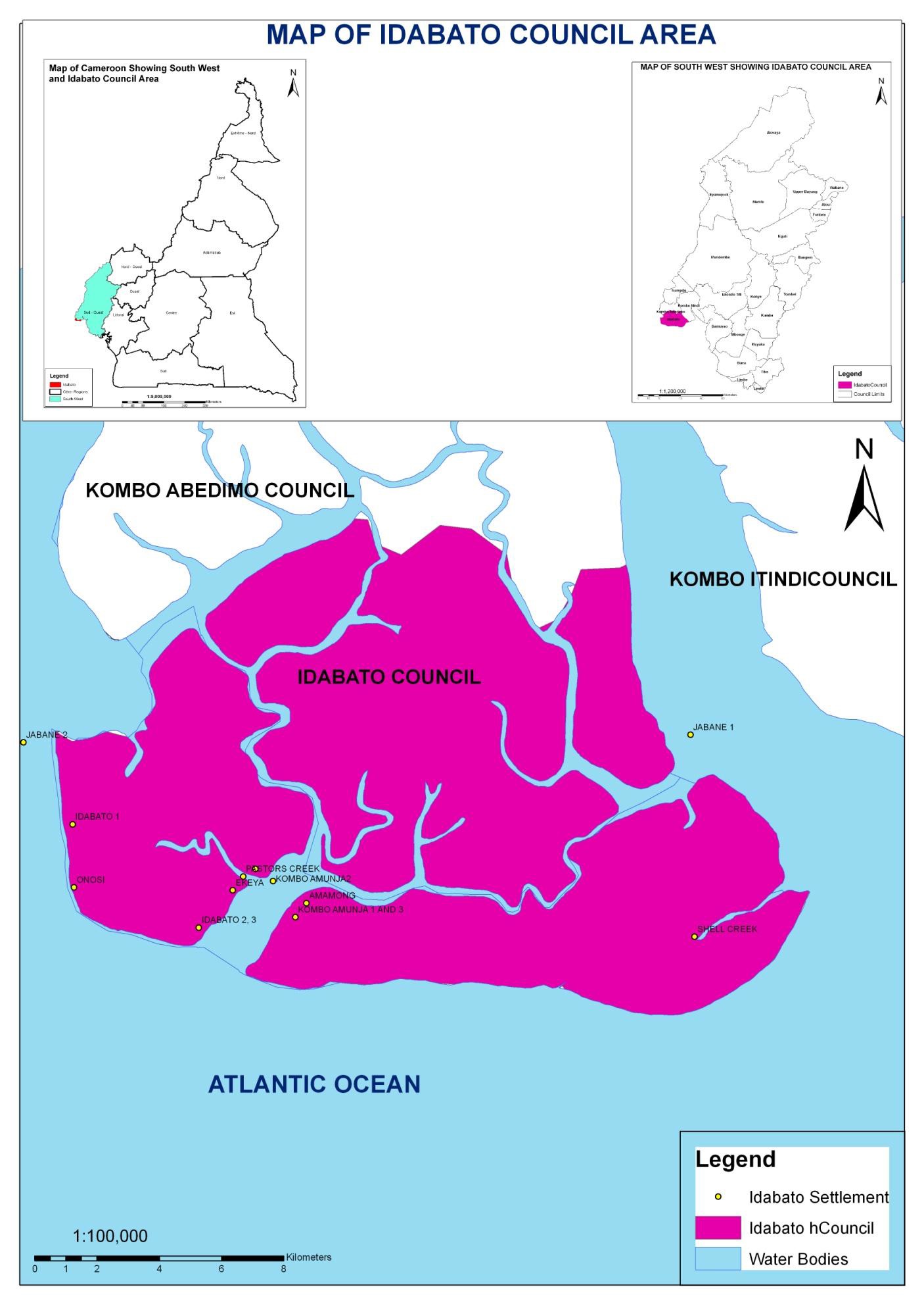
- Relief
Idabato council is found at the extreme end of the Bakassi peninsular and its closeness to the Atlantic Ocean makes the council vulnerable to flooding, marshy areas and swamps areas from high sea tides. The relief of the council is characterised by lowlands in general. There are areas as low as -16m (bsl) and the most elevated 14m given an average altitude of -2m for the entire council area. The interruption of the sea to the east by Mount Cameroon makes the area rich in oil deposits. The vegetation of the council is characterised by mangroves, swamps, several Creeks and sand-spits that stretch from the rocky coast lines of Fako to the Ndian River Basin.
- Hydrology
In terms of water resources, the council can only boast of its closeness to the ocean. One can hardly find any stream or rivers, only around the “ramification” creek that a stream is found. Local wells and poorly conceived boreholes cannot be realised in this area due to the shallowness of the water table. Some of the most prominent creeks are East Point, Serpentine Creek, Couchlon Creek, Ramification Creek, Argus Creek, Trojan Point, and North Channel.