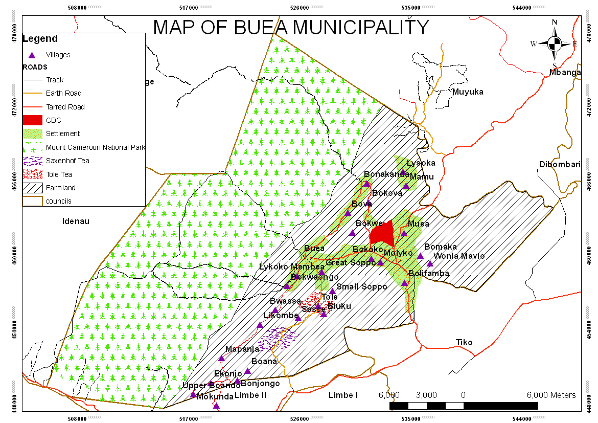
The Buea Municipal council is the Sub Divisional headquarter of Buea and the South West Regional head quarter of Cameroon. Created on the 29th of June 1977 by presidential decree No. 77/203, the Buea municipality has a surface area of 870 Sq.km, 67 villages, four distinct identified urban spaces as per outlined criteria (Buea station, Soppo, Molyko/Mile 17 and Muea). It is a highly complex community caught between a blend of urban, semi urban, rural and traditional settings.
Buea Municipality is bounded to the north by tropical forest on the slope of mount Cameroon (4100m above sea level). The mountain range extends to the beautiful sandy beaches of Atlantic Ocean. The town also share boundary with other major towns like the City of Limbe to the South West, Tiko municipality to the South East, Muyuka municipality to the East and Idenau district to the West. With an equatorial climate, temperatures are moderate with a slight seasonal variation (rainy and dry season).Buea has moderate economy with agricultural, administrative, business, tourism and the financial sector taking the central stage of the town.
Climate
Buea GMT time is +1 hour and is mostly cloudy. Average sunrise is at 06:16 and sunset at 18:10. In effect it has an equatorial climate with 2 major seasons. Rainy season which runs from March to October and Dry season, from November to May). Temperature ranges between 20 oC to 28 oC while, annual rainfall ranges between 3000mm to 5000mm.
The conditions here are generally the tropical rainforest climate with rainfall almost during the entire year. However, average monthly High/Low Temperature for these urban spaces ranges from 23oC low to 32oC high. This temperature increases as one moves downwards from Buea station to Muea. Several factors are behind this. Firstly, the principle of “higher one goes the colder it becomes” applies as the town is on the slopes of the mountain. Secondly, some areas have higher population intensity, activity and urbanization than others. Molyko for example has more infrastructures which reduces circulation and exchange of air.
Topography and soil
The area is composed of undulating high and low lands with many rocks and gravels due to volcanic eruptions. The soil type consists of basalts and is as a result of the first volcanic activity in the Fako Mountain area, which occurred in the cretaceous system. These soils have been weathered and partly covered by more recent deposits, thus the soils are black and in these areas are well drained due to the generally hilly nature of the terrain and the fact that they are free-draining.
The soil is very rich in nutrients and allows the cultivation of various crops such as tomatoes, cabbage, okro, pepper, corn, cocoyam, yams, cassava, plantains,, beans, vegetables and even some cash crops such as palm trees, cocoa and bananas. Citrus trees are less prosperous as one ascend and climate gets cooler. The soil and climate is very supportive for vegetation and agriculture though in some areas digging is difficult due to the stony nature of the rocks.
The vegetation is generally green almost throughout the year with fewer trees in areas of high concentration of houses. It is rare to move 200m without spotting green grass, shrubs, and fruit trees.