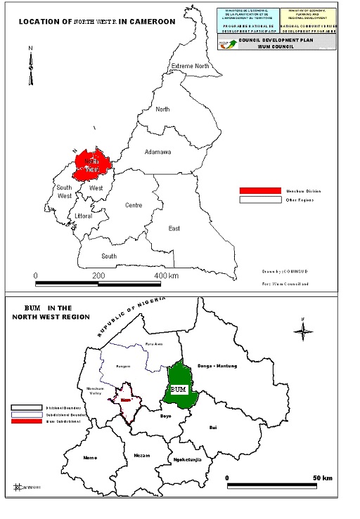
Bum Sub Division is located in Boyo Division with its headquarters in Fonfuka. The Sub Division has boundaries with Misaje Sub Division in the East, Wum sub division in the South, Belo and Fundong sub divisions in the West, Fundong and Furawa sub divisions in the North. The municipality is situated between latitudes 10 degrees 8 seconds and 10 degrees and 32 seconds east of Greenwich Meridian and between longitude 6 degrees and 23 seconds and 6 degrees 39 seconds North of the equator.
- Agriculture
- Commerce
Climate
Fonfuka Council area has the equatorial rainforest climate, which is characterized by two distinct seasons; the rainy and the dry seasons. The dry season runs from October to March and is characterized by high temperatures. The rainy season begins in March and ends in October with its peak periods in July and August. It is characterized by low temperatures. It is worth noting that during the months of December and January, the air is very dry and cold in the morning and evening periods and very hot in the afternoon periods. This period between December and January is known as the harmattan. In general, the lowland areas are warmer than the highland areas. This explains why the temperature of Fonfuka village is warmer than that of Saff, Sawi, Lakabum and other villages located up in the highland areas.
Hydrology
The municipality is richly blessed with streams and two main rivers and their tributaries give rise to wetlands. Very prominent is River Kimbi, which is the main tributary of River Katsina Ala in Nigeria. River Kimbi flows from Noni through Mbuk, Kichowi, Ngunakimbi, Mulung and Fonfuka and Faat Kimbi. River Jongah flows through Buabua and Subum. Farming activities take place in the wetlands in which vegetables, maize, cocoyam, beans, etc are grown.
Soils
The main soil types found in this municipality include alluvial soils in the lowland, wetland areas and plains. In the hilly slopes the thin immature, young soils are common and underlined by the granite parent material with little organic materials. These soils are affected by heavy leaching. Humus or topsoil are found mostly in the valleys and hilltops and are good in the cultivation of potatoes, beans, maize, coco yams, groundnuts and vegetables.
Flora
The vegetation is mainly montane, sub-montane forest and domesticated sub-montane forest. The remnant of the forest has characteristic tree species like Nitia sp, Noxia sp, Sheflicia sp and Gnedia sp. The domesticated sub-montane landscape which now looks like grasslands are occupied mainly by grazers for the rearing of cattle, sheep, goats and horses. This landscape gives beautiful green touristic sceneries during the rainy seasons. In the dry seasons, they are almost bare due to the over exploitation by cattle and constant bush fire.