The knowledge of minerals in the municipality is quite limited apart from minerals such as red laterite, stones, sand and aluminum. There is no research report on mineral resources, although the concerned divisional delegate made mention of these. This is a potential area for research.
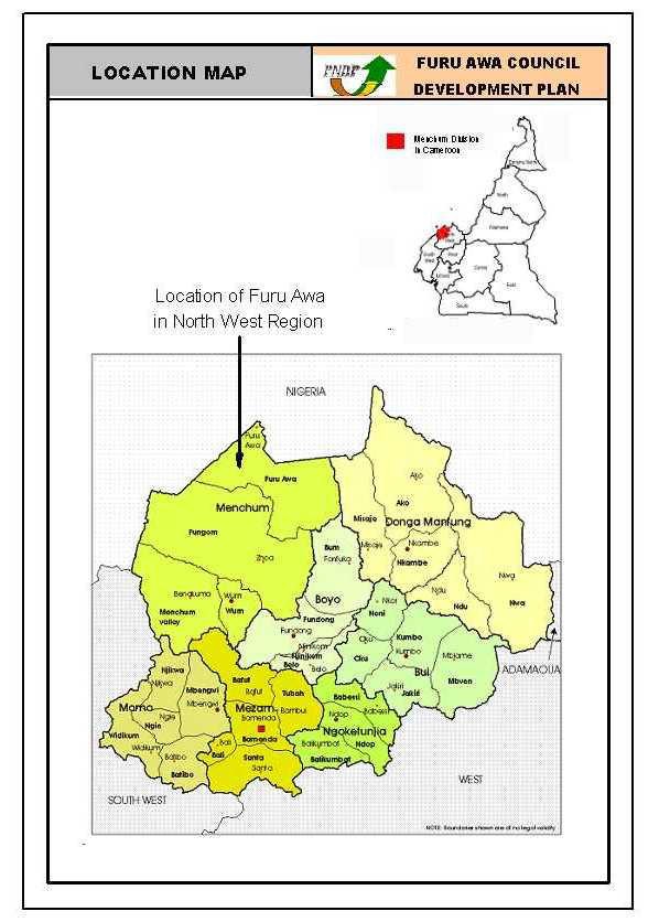
Furu-Awa council area is found in the northern part of Menchum division in the North-West Region of the Republic of Cameroon. Furu Awa council area has a population of about 19.000 inhabitants spread over a surface area of 1.500km2. This sub division was created in 1995 by the Ministerial decree No 95/082 of 24/04/95, bearing on the creation of the Furu-Awa Council. This council area is made up of 17 villages with its head quarter in Furu-Awa village. The main language spoken in Furu Awa council area is the jukum language. Other minor languages include the Akum and the fufulbe spoken by the Mbororos. Among the learned population, the English language is often used especially when communicating with strangers or visitors. The population of the Furu-Awa municipality is a conglomerate of ethnic groups. These include, the Awas which is the main ethnic groups and others such as the Kuted, Lubu, Buzem, Fulani, Wum, Titi and Akum. The population also constitutes migrants from neighboring Nigeria.
CLIMATE
There are two distinct seasons in the Furu-Awa Municipality which include the rainy and the dry seasons. The rainy season begins toward the end of March and covers a period of eight months up to mid November. The total annual rainfall for the council ranges between 2513mm and 2831mm. During mid August, there is abundant rainfall and too much cold. The dry season runs from mid November to mid March. The hottest periods and droughts are witnessed towards the end of February. Furu Awa is characterized by the equatorial type of climate. The favorable climate favors the cultivation of diverse food and cash crops such as groundnuts, maize, and cocoa. The mean daily temperature of 28oC favors the cultivation of most food and cash crops.
SOIL TYPES
The soil type ranges from loam, clayish, silt and sandy soils. The soil is dominated by volcanic soils at the foot of the mountains, ferruginous and silt soils and inorganic soils. This thus favors and permits the growing of a variety of agricultural products. There is a high level of erosion of the top soils especially those found on hill tops. Mud flows and landslides usually occur after heavy down pours. The banks of these rivers are loaded with alluvial soils that are good for off- season farming but there is little or no irrigation practiced here.
RELIEF (Topography)
The relief of the council area is rugged and undulating. It is characterized by mountain chains and hills covered by montane forest, shrubs and grassland. There are rocky cliffs in the municipality. The mountains and hills include Mt Buzong, Mt kpashim, Mt. Munzour Mt Bidzizi, Mt. Kwessu, Mt. Utiuck, Mt. Badgi and a host of others. Mt Buzong and Mt. Munzour are volcanic mountains.
Settlements occur on lowland with flat ground that is good for the construction of houses and transportation of farm products to storage places. Many villagers prefer to carry out agricultural activities on the plains rather than the steep slopes.
HYDROLOGY
Found in the North-West plateau, the Furu-Awa municipality is full of running springs, streams and waterfall. Though in abundance, the council has not yet made good use of it. Only Furu-Awa villages have benefited from this resource for the provision of drinkable water. Some of the villages remain without pure drinkable water especially during the dry season when the springs get dry. The flow of the rivers in Furu-Awa gives the village a good look. Some of the streams in the municipality includes, Mangara, Waekop, Kembo, Long-tanah Zang-kpan, Gamina, Nangwa, Katsina ala, Zang akpan, Zang-Sama, Gama Tosso, Tambou Mbere-yira and Echim to name a few. In some of the large rivers, there is the presence of crocodiles, different species of fish, turtle and other water animals.
VEGETATION
The municipality covers an extensive forest area. The council falls within the Sudano-Savanna zone which has the characteristic of grassy vegetation. Around Nkang extending to the Doumbo cattle ranch, large herds of cattle are being reared by the Mbororos. There is also transhumance in some of the villages such as Lubu, Nser and Kpep during the dry season. The large forest provides wood for fuel and timber. They also serve as habitat for a variety of animal species. They serve in the provision of non timber forest products such as Njangsa and bush mangoes. The council forest area possesses a lot of potentials that can be exploited for the benefit of the municipality. It has a lot of medicinal plants that are used for the treatment of various diseases. Around settlements and in some spotted parts of the council, there is man made vegetation. There is the growth of plants such as cocoa, plantains, palms, mangoes and oranges which help make the council area to look evergreen especially during the rainy season.