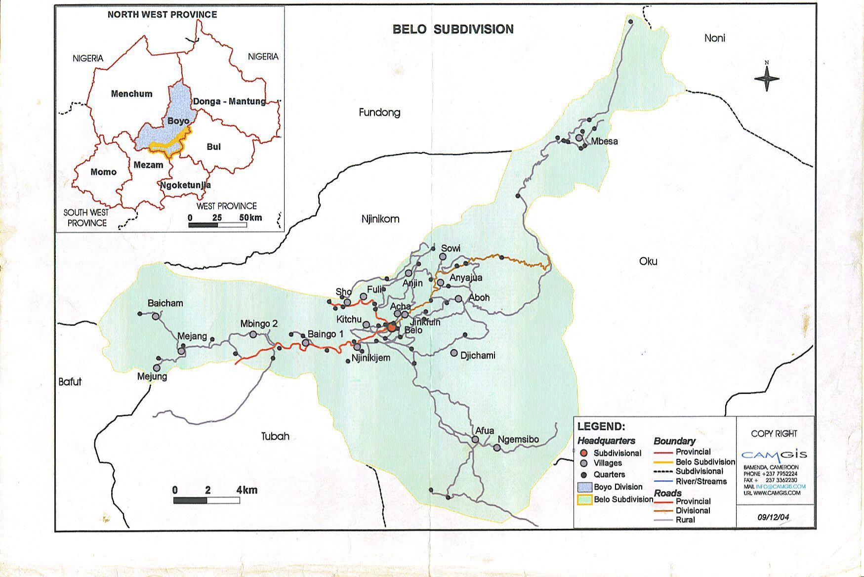
Belo Rural Council was created by Presidential Decree No. 93/321 of 25th November 1993 and its municipality covers the entire sub division. The Council went operational in 1996 and till date three Mayors have been at the helm of the Council. Presently, it is simply called Belo Council. The Belo council is found in Belo sub division in Boyo Division of the North West Region (Figure 1). It is located within the grassland savannah area of the mountainous western highlands region of Cameroon. It is situated along the Bamenda-Fundong highway, about 50 km from Bamenda. Belo sub Division is found between latitude 6o4’ and 6o20’ north and between longitude 10o11’ and 10o30’ East. It is surrounded by Fundong and Njinikom sub divisions to the west and to the east by Oku and Babessi sub divisions while to the north it is bounded by Noni sub division and to the south by Tubah and Bafut sub divisions. The entire sub division covers a surface area of about 346 square kilometres.
The Belo municipality covers 29 villages with 96 quarters and has a population estimate of 88,664 inhabitants. There are basically 5 ethnic groups in the municipality. These are: The Koms, Mbessas the Fulanis, the Mejungs and the Mejangs. The dialects spoken include the Kom, Mbessa, Mejang, Mejung, Baicham and Fulani. Pidgin is a lingua franca that is very popular, especially in the urban space and amongst the young. A portion of the population speaks English language but this is strictly limited to the literate class. A handful of people also speak French.