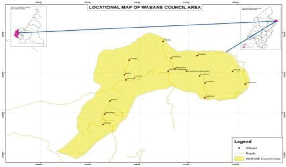
The Wabane council area is one of the three councils in Lebialem Division. It is found between latitude 5034’ and 5044’ and longitude 9055’ and covers a total surface area of 1800 sq km. It has an estimated population of 62,342 living in 40 administrative units known as villages. It is bordered to the North by Batibo Sub-Division of Momo Division (North West Region), to the South by Upper Bayang Sub Division of Manyu Division, to the East by Mbouda-Bambotus (West Region) and to the West by Alou Sub-Division of Lebialem Division. Major access route to the council area is through Dschang (Menoua Division), Lewoh (Lebialem Division) and Guzang (Momo Division) and Kombu (Bamboutus Division)
Geographically, Wabane is divided into three geographical parts made up of the lower be
The principal economic activity in the municipality is agriculture which occupies at least 95% and therefore economic progress largely depends on the exploitation of agricultural potentials. Other economic investment activities are very low, probably due to the enclave nature of the area. This can be confirmed by the limited number of service providers in different sectors. This agricultural sector is dominated by the production of food crops and cash crops. Livestock and fishery activities equally prevail in the area, though to a lesser extent. This is seen by the rearing of animals like cattle, goats, sheep in the upper zone and in a general trend in the entire municipality, each household may be having a few fowls let in the wild and a pig sty with at least a pig. Some hunting is practised and fishing though to a very limited extent. Rural urban migration is significant in the council area due to the poor economic situation and low rate of social amenities thus posing a difficult livelihood. Supplementary economic activities like petit trading, and transport services are practiced by a very limited percentage of the population.
Climate
The council area experiences two seasons – the dry season that begins in November and ends in March and the rainy season that commences in April and stretches up to October. It has 3 distinct temperatures owing to the marked difference in topography and vegetation. The lower belt popularly called Lower Mundani has a characteristic hot temperature typical on a tropical forest zone. The middle belt (where the council building is found) has a higher altitude and the temperature is mild. The upper belt (north-west) is tropical savannah with an altitude of up to 2100m. Here the temperatures can go below 180C in the months of December to January.
Soils
The difference in altitude and vegetation types gives rise to different soil types. From the field studies, soils of the lower belt to parts of the middle belt can be described as sandy-loam to reddish alluvial (ferralsols). The soils of the lower belt are highly exploited for plantation agriculture (oil palm and cocoa plantations) and to a lesser extend subsistence crops like plantains, cassava, cocoyam’s, bananas and pepper). The upper belt has rich alluvial and silty-loam soils interspersed with very barren chalk and clay soils. These soils serve for very high commercial market gardening crops like Irish potato, cabbage, carrots and leeks.
It is worth noting that the soils of the middle belt are loose, highly leached and more exposed to soil erosion and landslides leading to its characteristic poor nature.
Relief and Landforms
In terms of landforms, it is very varied with three distinct topographical regions and marks the end of the Manyu plain. The topography or landform is undulating and characterised by elevated, prominent mountainous terrain, with altitude ranging from lowland Bechati, Besali, (570m) and 72m (Nkong) through 1470m (Alongkong) to about 2200m at M’mouck Leteh. At the Bamumbu Fondom, hill slopes are steep to very steep, narrow boulder strewn crests and deeply incised valleys. The area of M’mouck Leteh is equally undulating but with broad hilltops and gentle slopes suitable for intensive vegetable farming.
Wind types
Two main characteristic types of winds blow across the area. These are the north-east Harmatan winds that come with the dry season and the south-east monsoon that come with the rainy season. The coming of the Harmatan winds is noticed in the council area in the month of November by violent winds particularly in the upper plateau which more often than not cost great damages in buildings and crops. This violent effect of the winds is also noticeable in the month of March-April during their take-off which is a transitional period between the Harmatan and the quick-off of monsoon winds in May. However the monsoon winds operate in an atmosphere of a gentle breeze. The cold dry Harmatan and warm wet monsoon winds give rise to the characteristic cold dry season and warm rainy season of tropical climate, experienced in the council area.
Hydrology
The main rivers and streams in the council area are found in the lower and middle belt. There are equally many drinkable springs in the whole of the council area. The main river of the municipality known as river Meyi gets it rise from mount Bamboutous and to it is added many other tributaries downstream resulting in River Manyu. During the rainy season, many of these streams overflow their banks and become fast-flowing and dangerous to cross.
The upper tropical savannah area of M’mouck Leteh , Atsuala, Magha and Fonenge have few streams and springs, many of the springs dry off in the dry season leading to acute water shortage both for household use and irrigation.