- The major threats to the environment include the deforestation of the watershed resulting in significant reduction of the volume of water in the streams and springs. Threats of landslides are eminent on the hill slopes along the new road through Dom to Banten and on the roadside of the Dom-Mee road.
- Bushfires are used here as means of regenerating pasture for grazing and, to a limited extent, for hunting. This destroys animal habitats, displaces animal species and could even render extinct some species.
-
Slashing, burying and burning of the buried grass are rampant malpractices in the municipality, which renders the soil more infertile.
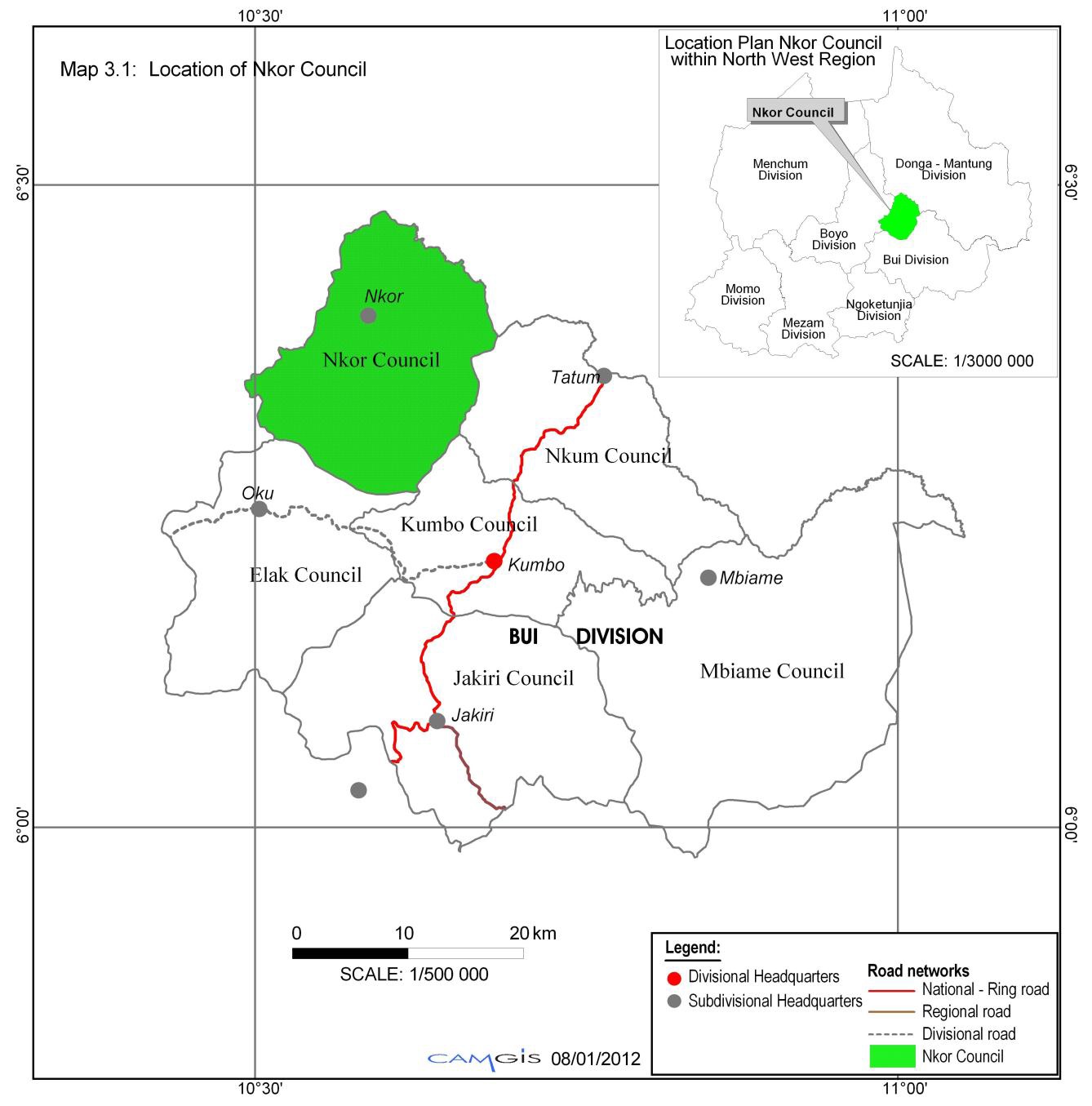
Nkor council area engulfs the entire Noni Subdivision, which is found in Bui Division ofthe North West Province of Cameroon. The estimated surface area of Nkor Council is 325.7 Sq.km. The population is sparsely settled across the Council area under ten (10) traditional fondoms, with six (6) principal concentration zones along the Noni Ring Road at Mbinon, Lassin, Nkor, Dom, Din and Djottin. Nchine, Mee, Ngeptang, Nkale and Bamti are some major quarters linked to the principal population concentration zones of Mbinon, Nkor and Din respectively The Municipality is situated between latitudes 6°38` and 6°.48`north of the equator and longitudes 10° 49’ and 10° 69’ east of the Greenwich meridian
L'agriculture
Livestock fisheries and animal husbandry
Commerce
The Nkor council area is characterised by two main seasons, namely, the rainy and dry seasons. The dry season runs from October to March and is characterised by high temperatures and dusty conditions, a major trademark of the northeast trade winds. The rainy season begins from March and ends in October with its peak periods in July and August. It is characterised by low temperature and moist conditions, peculiar of the southeast trade winds that brings rain. It is worth noting that during the months of December and January the air is very dry and cold during the morning and evening periods and very hot in the afternoon periods.
In reality, Noni climatology identifies four seasons in a year, namely; Nyiim ( the dry season), which runs from the beginning of December to the ending of February; Mondvuum , which marks the transition from the dry season to the rainy season, runs from the beginning of March to the ending of May; the rainy season proper, known as Bvudaam, runs from the beginning of June to the ending of August; Fweh, which marks the transition from the rainy season to the dry season, runs from the beginning of September to November ending.
On account of the absence of a meteorological station within the council area, no record of actual temperatures exists. Nevertheless, it must be pointed out that the council falls within the mid-altitude agro-ecological zone 5 (altitude : 800-1400m above mean sea level) that, like all other agro-ecological zones, has witnessed an increase in the maximum annual temperature, going from 28oC in 1987 to 34oC in 2005 – i.e. a staggering 21.43% increase in just six years. Despite this general trend, we still need specific temperature data in order to be better informed about the local micro-climate