The Mbonge Council area is endowed with a good number of biophysical assets, most of which are natural resources like land, soils, forests, Non-Timber Forest Products, sand, gravel, laterite, rivers, lakes, and mountains. Land generally made up of very fertile soils is the main asset for agricultural development of the area. In addition to the agricultural prowess of the municipality, substantial amounts of income comes from the exploitation of other biophysical assets like the forest, NTFPs, rivers, sand, gravel, etc .
However, a lot of constraints are also attached to these assets. The general problem of inaccessibility to most of the places (where these assets are found) constitutes a main constraint. Lack of appropriate technology, machines, tools, competent human resources is also a barrier to the under-exploitation of these biophysical assets.
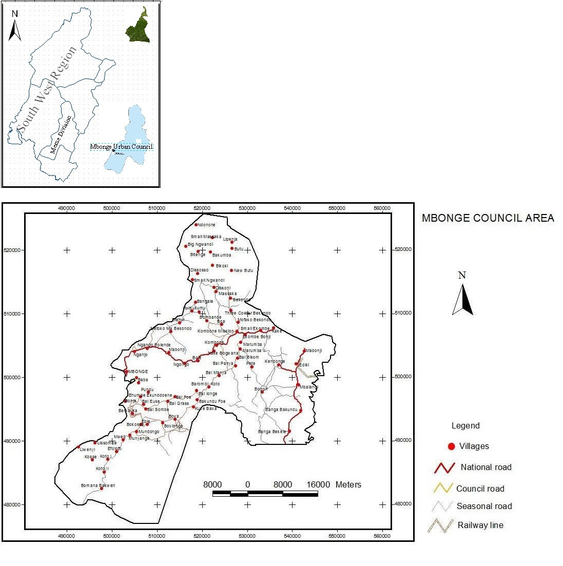
Mbonge council was created in 1977. It is situated 56km from Kumba. It is part of Meme division of the South West region of Cameroon. The council is made up of 86 villages covering a total surface area of 3000km2 with a population size of over 200.000 inhabitants, which makes it one of the largest councils in the country. Mbonge council is bounded to the North by Kumba council, to the South by Bamusso council, to the West by Ekondo Titi council, and to the East by Muyuka and Idenau councils.
This municipality is sub-divided into four court areas: Mbonge, Kombone, Bekondo and Bomboko. These court areas regroup ethnic groups of common origin.
The socio-economic environment is characterized by activities such as the collection and petty trading in NTFPs, provision stores, liquor, drug stores, motor-taxi (okada) and catering activities. The biggest economic activity in the area is the agricultural sector where farmers are engaged in cocoa business. Cocoa production activities are seasonal—the peak season being the harvesting, processing and evacuating the cocoa beans to distant markets. Moreover, other businesses only thrive during this season, such that even young women come from the cities and settle there to prostitute and leave during the off season. The off season is characterized by the collection of NTFPs and growing of vegetables by the women at low scale. Also goods and commodities are generally very expensive in this area due to bad roads and in the off season even more expensive because farmers have to borrow at exorbitant interest rates.
Climate
Unlike most regions in Cameroon, the Mbonge Council Area has a typical equatorial climate with two major seasons which are the rainy and the dry seasons. climate is hot and dry, meanwhile in the rainy season, the climate is cold and humid. In the past the rainy season occurred from March to October and the dry season from November to February. But with the present climate change the seasons have not respected their schedule in the recent years. The area has been experiencing drastic changes as rains have come earlier and the dry season has also experienced some unexpected rains. For instance, rainfall was experienced right up to December in 2010 instead of October as was the case in the past. This has altered the planting and production seasons of cash and food crops, as well as other economic activities.
Soils
This area has a mixture of laterite, sandy, clay and volcanic soils which are very rich in humus, brought about by the rapid decomposition of litter and debris, enhanced by the rainy and the dry season. The soils here are generally very fertile and favour the growth of food and cash crops. However, the soils are gradually losing fertility due to increased slash and burn, soil exposure, pollution, over cropping and leashing.
Relief
The relief of the area is generally level while some areas are undulating with even small hills that can be spotted here and there, though very few in numbers. However, the topography in some areas is hilly with steep and gentle slope like in the cases of Big Ngwuandi, Small Ngwuandi and Disoso which are furthest and located at the top of the hills. The altitude of the Mbonge Council area generally is low with some areas below 100 m above sea level. The highest village is about 550m above sea level. This low altitude gives way to very hot temperatures especially in the dry season and during the day. This hot climate is also very favourable to crops which not only grow well but mature rapidly.
Hydrographic
The main water courses in this area are rivers such as the Meme (the longest river in the South West Region) which cuts across many of the villages interspersed with streams and springs. The water volume of river Meme, springs and streams increases significantly during the rainy seasons. Another major water body in this area is the lake Disoni which flows out and joins the Ube River and then further to the Meme in another part. Water courses are used in many ways mainly for farming, fishing, home use (drinking, laundry), catchments and recreational activities like swimming. The water courses can be harnessed and used for large scale irrigation, transportation, hydro-energy, potable water and large scale fishing.