Mamfe municipality is found in Manyu division of the Southwest Province of Cameroon. It is located in the northern part of the Southwest. It is about 74 km away from the Cameroon – Nigeria BorderThe council shares common boundaries in the north with Akwaya council, in the east and south with Eyumojock council and in the west with Tinto council.
Economic activities in the municipality fall within three main sectors. These sectors are:
- The primary sector defined by natural resource management activities such as agricultural, animal rearing, fishing and forest exploitation.
- The secondary sector is defined by mining and industrial activities .
- The tertiary sector is characterized by the production of service such as transportation and banking
Climate
The Mamfe municipality falls within the Equatorial Climate Zone. It has the Equatorial Rain Forest Climate, which is characterized by two distinct seasons; the rainy and the dry seasons. The dry season runs from October/November to March and is characterized by elevated temperatures (30c-32c). The rainy season begins from March/April and ends in September/October with an annual average rainfall ranging between 3500mm – 4000mm, and peak periods in the months of July and August.
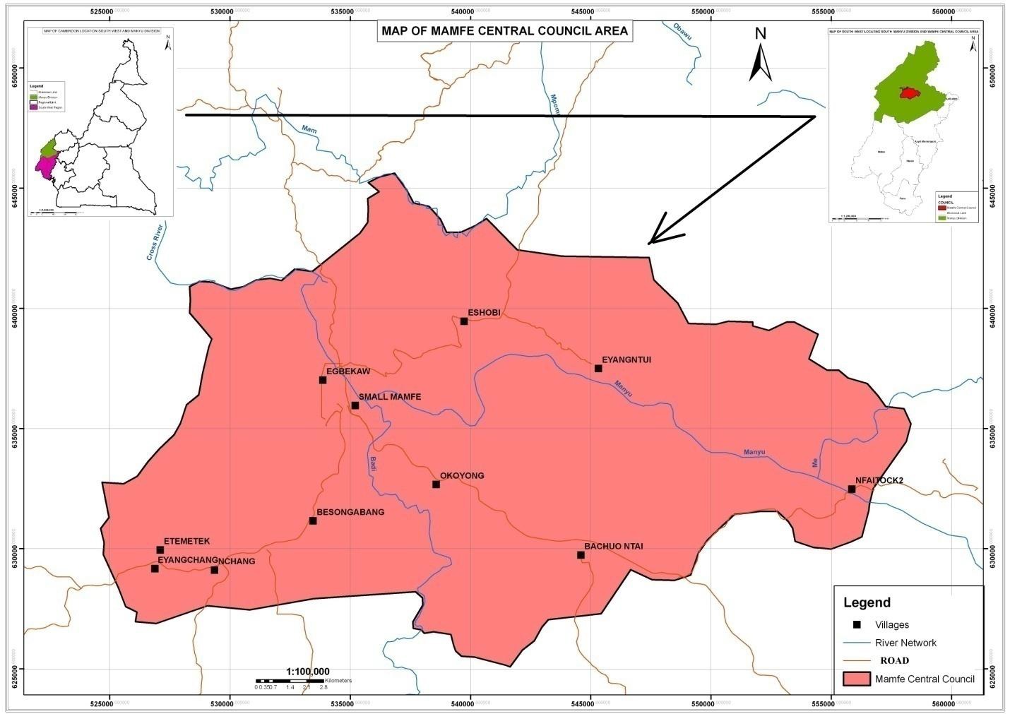
Hydrology
The area is richly watered by the Badi and Manyu rivers and their tributaries. The Badi and Manyu rivers are prominent rivers that join to make up the ‘‘Cross River’’ that flows into Nigeria. Some streams do exist in the area like the Monyen and Baku streams. A waterfall exists in Bachou Ntai. Swamps exist in Bachou Ntai, Lala quarters (Mamfe town), towards Egbekaw village and another towards the Catholic Mission in Mamfe town.
Soils
Three main types of soil exist in this municipality: the sandy soil, humus or top soil and the red clay soil.
Vegetation
Generally, the Equatorial Rain Forest occupies the area and it also falls within the Tropical Evergreen Forest Type of Cameroon. It is also part of the Guineo-Congolian Floristic Region with altitude ranging from 90m-500m above sea level. We have the primary and secondary vegetation types in the area. The variation in the above-mentioned characteristics causes the existence of two unique types of vegetation in the municipality. The vegetation types are the Lowland rain forest and the Mid-Altitude Forest.
Forest
Forest Resources include Timber, Non-Timber Forest Products (NTFPs), Wildlife. No data on the quantity of timber in the area exist but it is estimated that over 80% of the area is covered by forest. Meanwhile a good quantity of NTFPs and Wildlife do exist in the forest
Mineral
Mineral deposits exist in some areas of the municipality, most of which are not exploited. The municipality is endowed with a lot of quarries which is highly exploited, unfortunately about 50% of the exploiters are illegal. If stricter measures are put in place to follow up the exploitation of this mineral, it will bring in much income to the council.